Putting the Canary Islands on the map
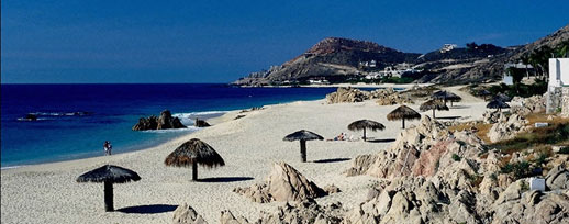
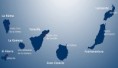
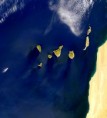
Dotted in a gentle curve, the archipelago of the Canary Islands lies in the Atlantic Ocean to the west of Morocco in Saharan Africa. The seven main islands are inhabited with a total population of more than two million - the majority living on the larger islands of Gran Canaria and Tenerife. The total area of these volcanic islands is 7,447sq km (2,875 sq miles) and encompasses a surprisingly rich variety of landscapes, from beaches and desert - like areas to dramatic mountain ranges and green woods. Hot winds from Sahara ensure that the islands enjoy a warm climate all year round with temperatures averaging 18°C (64°F) in winter and 24°C (75°F) in summer.
Although just 100 km (62 miles) fro Africa, the Canary Islands belong to Spain - a country over 1,100 km (680 miles) away. The islands population of over 2 million, is swollen each year by more than 7.5 million tourists.
Photo Gallery: Putting the Canary Islands on the map
Contact
Andy & Ian
tenerife-experience@hotmail.co.uk
Ian +44 7748780814
skype swanndog1976
or
Andy +44 7857125824